

Exploring Basse-Terre by car: Routes, driving tips and essential stops
Driving through Basse-Terre means seeing a different side of Guadeloupe around almost every bend. Tropical rainforest gives way to villages along the leeward coast, volcanic mountains rise above fern-lined roads, and in just a few miles you can move from Caribbean Sea viewpoints to cool, misty mountain scenery.
That variety has one very practical consequence: in Basse-Terre, the distance shown on a map is not enough to plan your day. Roads are often winding, some stretches stay wet after a shower, and the best-known natural sites can get busy. The goal is not to fit in as many stops as possible, but to connect them in a realistic order.
This guide gives American travelers two simple ways to explore Basse-Terre by rental car: a one-day route focused on the Route de la Traversée and the leeward coast, or a two-day plan that adds Saint-Claude and the La Soufrière area without turning the trip into a race.
Planning a day trip or a multi-stop drive through Basse-Terre? Choose a rental car that fits your group size, luggage and driving comfort before you lock in the route.
Before you go: What to know about driving in Basse-Terre
Basse-Terre is not difficult to explore by car, but it requires more attention than the flatter main roads of Grande-Terre. Curves are frequent, grades are steeper, and dense vegetation can keep parts of the road damp even after the rain stops.
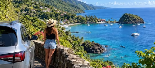
For American drivers, the biggest adjustment is often pace: plan by travel time and road conditions rather than mileage alone. A destination that looks close on a map may take longer because of mountain roads, photo stops, slower vehicles or limited parking.
Fill up before a long forest or mountain drive.
Download your route in advance if you rely heavily on GPS.
Keep water, a light rain jacket and appropriate shoes in the car.
Do not leave valuables visible inside the vehicle when you head out on foot.
Build in extra time before a boat trip, restaurant reservation or scheduled activity.
Day 1 — Route de la Traversée and the Leeward Coast
Route de la Traversée: Drive into the heart of the rainforest
The Route de la Traversée, or RD23, runs from Petit-Bourg to Pointe-Noire for about 17 kilometers (roughly 10.5 miles) through the Basse-Terre mountain range. Its value is not simply getting from one side of the island to the other — it is one of the easiest ways to experience dense tropical rainforest without committing to a long hike.
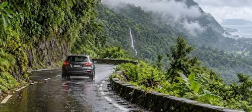
Without stops, the crossing can be fairly quick. To enjoy it properly, allow about two to three hours including pauses. A standard passenger car is suitable for this route; what matters most is adjusting your speed to the curves and road surface.
After a shower, slow down before entering curves, increase following distance and avoid sudden acceleration or hard braking. The pavement may remain wet even after the sky has cleared.
First stop: Cascade aux Écrevisses
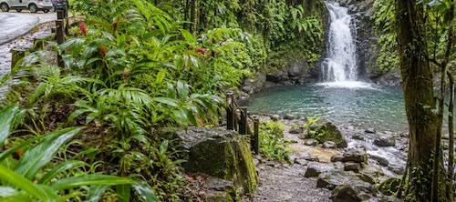
Cascade aux Écrevisses is one of the easiest stops to build into the drive. It sits directly along the RD23, with a designated parking area nearby. From the parking lot, a marked and improved trail reaches the waterfall in about a 10-minute walk.
That easy access also makes the site popular. Arriving early usually makes parking easier and the experience more peaceful. The parking area and swimming area are not supervised. After heavy rain, be especially careful near the river, do not cross if the water level is rising, and use caution when crossing the busy RD23.
A useful planning tip: allow more time than the walk itself. Parking, the trail, photos and time by the water can easily take up a meaningful part of the morning.
Maison de la Forêt, Bras-David or a picnic area: Should you add another stop?
Yes, as long as you do not try to do everything. Maison de la Forêt, the Bras-David area and roadside recreation areas let you spend more time in the rainforest without turning the day into a major hike.
If the weather is very wet, you are traveling with young children or you want to save the afternoon for the coast, choose only one additional rainforest stop beyond Cascade aux Écrevisses. The quality of the day depends more on time spent at each place than on the number of stops you can check off.
Pointe-Noire, Deshaies or Bouillante: Pick one direction for the afternoon
Once you reach the western side of the island, the atmosphere changes. The leeward coast opens toward the Caribbean Sea and works well for an afternoon that combines scenic driving, lunch, a village stop and time by the water.
The most common mistake is trying to fit Deshaies, Bouillante, several beaches and a water activity into the same afternoon. The roads remain winding, and every stop takes time. It is usually better to choose one direction based on the kind of experience you want.
Deshaies option: Park once and continue on foot
Deshaies is best enjoyed at a slower pace. The center is compact, and the waterfront, restaurants and small streets are close together. During busy periods, it is often smarter to take a reasonable parking space when you find one and walk rather than circle repeatedly for the closest possible spot.
If you plan to continue to a beach afterward, leave extra time for parking there as well. An earlier arrival or a later lunch can make the whole stop feel much smoother.
Bouillante option: Malendure and time on the water
Bouillante is a good choice if you want to combine driving with a marine activity. The Malendure and Réserve Cousteau area attracts scuba divers, snorkelers and travelers booking boat trips. If you have an activity at a fixed time, build the second half of the day around that reservation rather than trying to squeeze it between multiple stops.
In October, conditions can be pleasant for water activities, but they still vary day to day. Always check sea conditions, weather and your operator’s instructions before heading out.
Spending most of your trip in Basse-Terre? The Baillif location can be a convenient option for picking up or returning your rental car closer to this side of the island.
Day 2 — Saint-Claude and La Soufrière
Use the second day for southern Basse-Terre and the La Soufrière area. Here, the route is only part of the planning: elevation, weather and limited parking matter too.
Driving to La Soufrière: How far can you go by car?
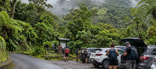
You can drive through Saint-Claude to the Bains Jaunes area, at roughly 950 meters (about 3,120 feet) above sea level. Bains Jaunes is a well-known starting point for hikes toward La Soufrière. The parking lot is free but very small, with roughly 15 spaces.
That makes an early start useful for two reasons: hiking conditions are often more comfortable, and you have a better chance of finding a legal parking space without blocking traffic. The parking area is not supervised, so do not leave valuables visible in the vehicle.
Summit access: Check current rules before you go
Access to some parts of the La Soufrière summit area is regulated because of volcanic activity and gas exposure risks. Visitors should not cross safety barriers on their own. Access to restricted areas and craters requires an authorized professional guide and appropriate equipment.
Rules and access conditions can change, so check the latest information from Guadeloupe National Park before your hike. For this type of mountain visit, checking the night before or the morning of the hike is far more useful than relying on information saved months earlier.
Mountain weather can be completely different from the coast
La Soufrière is cooler, wetter and often cloudier than the coastline. It can be sunny in Sainte-Anne or Le Gosier while the summit is still covered in mist. Before driving up, check weather conditions specifically for the mountain area.
If visibility is poor or heavy rain is expected, it is often better to adjust the plan and move the hike to another day. Keeping a coastal activity as a backup prevents the entire day from depending on one weather window.
Driving in Basse-Terre: Rain, steep grades and parking
These three issues are closely connected. Wet roads increase travel time, steep grades call for smoother driving, and a full parking lot can throw off an overly tight schedule. The best strategy is to keep some flexibility and avoid stacking several time-sensitive reservations into the same day.
Slow down before entering a curve, not halfway through it.
Increase following distance on wet pavement.
Avoid sudden acceleration and hard braking.
Turn on your headlights when visibility drops and stay alert for motorcycles and scooters.
Never enter a flooded roadway or ignore a temporary closure.
After heavy rain, check access conditions for waterfalls, rivers and trails before leaving the main road.
For parking, use designated spaces even if they require a short walk. Avoid narrow shoulders, private entrances and any spot that could block traffic. At locations with limited capacity, arriving early is usually the simplest solution.
What kind of rental car is best for Basse-Terre?
You do not automatically need an SUV for the standard road routes described in this guide. The best vehicle is the one that fits your group, luggage and confidence level behind the wheel.
Couple or light packers: an economy or compact car makes maneuvering and parking easier.
Family with luggage: prioritize usable cargo space and comfort on winding roads.
Automatic transmission: a good option if you prefer not to shift repeatedly on hills and curves; book early if an automatic is essential for you.
SUV: useful for extra room or comfort, but not required simply because you are visiting Basse-Terre.
In fact, choosing a vehicle that is too large can make some parking situations and tight maneuvers less convenient. The most important factor is feeling comfortable driving it for several hours on varied roads.
Checklist before a day in Basse-Terre
Check the weather for the exact area you are visiting, not just the general Guadeloupe forecast.
Check official access information if a hike, waterfall or natural site is a priority.
Fill up or check your vehicle’s range before a long loop.
Bring water, sun protection, a light rain layer and suitable shoes.
Start early for sites with limited parking.
Group stops by geographic area.
Keep at least one hour of buffer time in the day for delays or changes.
Exploring Basse-Terre by car: The best itinerary is the one that leaves room to breathe
Basse-Terre is ideal for a road trip as long as you do not treat it like a checklist. The Route de la Traversée deserves stops, Deshaies and Bouillante are better when you are not rushing, and La Soufrière requires attention to weather, parking and access rules.
For one day, focus on the rainforest and one section of the leeward coast. With two days, add Saint-Claude and La Soufrière without backtracking across the island. That structure also makes it easier to move a hike or water activity if conditions change.
That is where having a rental car becomes genuinely useful: not because it lets you see the highest number of places, but because it gives you the flexibility to adapt the day, follow better weather and enjoy each part of Basse-Terre at a realistic pace.
The Route de la Traversée is about 17 km, or roughly 10.5 miles. Without meaningful stops, the drive can be fairly quick. To include Cascade aux Écrevisses, rainforest scenery and another stop, allow about two to three hours.
Yes. It is directly off the RD23 and has a designated parking area. From the parking lot, allow about a 10-minute walk on a marked trail to the waterfall. The parking area and swimming area are not supervised.
It may be possible on paper, but it is not recommended if you actually want to enjoy each stop. Roads are winding and parking takes time. A better plan is one day for the Route de la Traversée and leeward coast, and another for Saint-Claude and La Soufrière.
Bains Jaunes is a common starting point. The parking lot is free and has roughly 15 spaces, so an early arrival is especially helpful. Always check current access conditions before the hike.
Access is subject to specific regulations. Some areas near the craters are closed or accessible only with an authorized guide and the required equipment. Check official information before departure.
Not necessarily. For the standard paved-road itineraries in this guide, an economy or compact car can work well if it fits your passengers and luggage. The priority is choosing a vehicle you are comfortable driving on winding, steep or wet roads.
